DOES REPORTING NUISANCE FLIGHTS MATTER?
We are sometimes asked “Does reporting nuisance flights make a difference?” The answer is YES. One person who recently reported a nuisance flight received a response from Davis-Monthan Air Force Base that shed some new light on things.
This information has been hard to come by, but we learned from the USAF that:
There are “two Military Training Routes (VR-259 and VR-263) where fast moving jets are authorized to fly low-level routes.
In the Tombstone MOA, aircraft are permitted to fly down to 500 feet above ground level. On VR-259 military aircraft can fly down to 300 feet above ground level and down to 100 feet above ground level on VR-263. While military aircraft can fly at these lower altitudes, the Federal Aviation Regulation 91.119 does specify that aircraft may not be operated closer than 500 feet to any person, vessel, vehicle or structure. So while aircraft may be able to fly as low as 100 feet above ground level, in the vicinity of people or structures, the aircraft would have to be either 500 lateral feet away from a person or structure or 500 feet over the top.”
Are these rules being followed? We don’t think so, but we need more reports of violations. We’ve asked the questions and are filing this information for future comments and complaints.
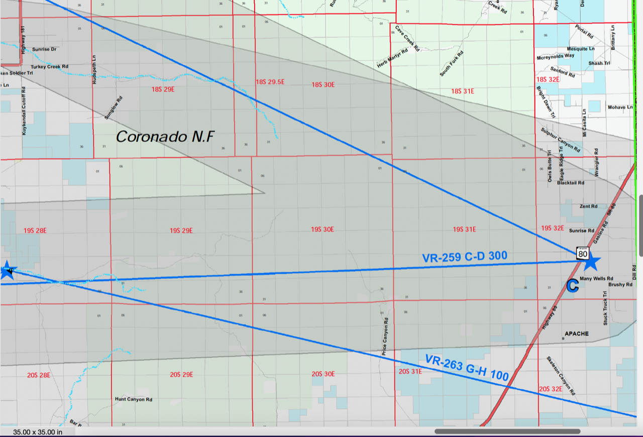
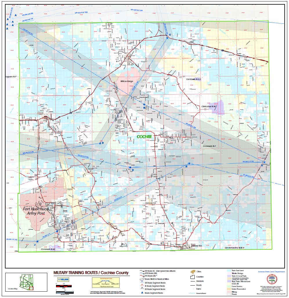
A map of these VRs is shown below, as well as the full text of the USAF response.
So YES, your input makes a difference, so KEEP REPORTING THOSE NUISANCE FLIGHTS. These reports go to Davis-Monthan and the Arizona Air National Guard, with copies to the submitter and Peaceful Chiricahua Skies.
Full text of USAF response:
Ma’am,
Thank you for contacting the 355th Wing at Davis-Monthan Air Force Base. I wanted to provide some information on why you are observing military aircraft near your property in the Chiricahua Mountains.
Using the GPS information you provided, your parcel borders the Tombstone Military Operations Area (MOA), which encompasses 2.5 million acres in southeastern Arizona and southwestern New Mexico. It has been a designated special-use airspace MOA since 1975.
Flying units from Davis-Monthan Air Force Base, the Arizona Air National Guard, US Army, and other military units utilize this airspace for vital training activities including, but not limited to, air combat maneuvers, air intercepts, and low altitude tactics. Further southwest of your location, there are also two Military Training Routes (VR-259 and VR-263) where fast moving jets are authorized to fly low-level routes.
In the Tombstone MOA, aircraft are permitted to fly down to 500 feet above ground level. On VR-259 military aircraft can fly down to 300 feet above ground level and down to 100 feet above ground level on VR-263. While military aircraft can fly at these lower altitudes, the Federal Aviation Regulation 91.119 does specify that aircraft may not be operated closer than 500 feet to any person, vessel, vehicle or structure. So while aircraft may be able to fly as low as 100 feet above ground level, in the vicinity of people or structures, the aircraft would have to be either 500 lateral feet away from a person or structure or 500 feet over the top.
Here is a link to the FAA regulation: http://rgl.faa.gov/regulatory_and_guidance_library/rgfar.nsf/bf94f3f079de2117852566c70067018c/91693c93525de33e862576c100763e31*
If you’re interested in looking at an Aeronautical Chart that shows the MOA you can use this website called Sky Vector ( https://skyvector.com/). It’s not a Department of Defense website but might be helpful. You can select Arizona from the “Charts” option.
We log all noise complaints we receive and share them with base operations/flight personnel. Complaints are also briefed quarterly to airfield operations senior leaders. Your complaint has been logged and reported.
I hope this information has been helpful in explaining the military’s use of airspace near your residence.
All the best,
Nicole
NICOLE M. DALRYMPLE, GS-11, USAF
Chief, Community Engagement
355th Wing Public Affairs
Davis-Monthan Air Force Base, Arizona
*This link has apparently changed. See here.
Maps of VRs:
Blowup of detail: